In 2024, St. Louis experienced its deadliest year on record for pedestrians.
As city leaders invest millions of dollars in traffic safety improvements, WashU Continuing & Professional Studies (CAPS) Geographic Information Systems (GIS) students Dash Martin and Margaret Mulligan wanted to understand a simple question: What impact are those changes actually making on the ground?
Their search for answers took them deep into crash reports, traffic-calming projects and thousands of data points spread across St. Louis streets.
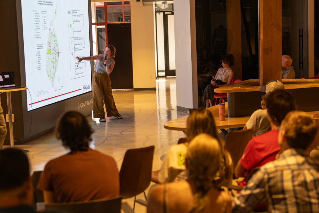
The pair shared their findings in June at Geosaurus Unleashed, a monthly geospatial technology event hosted at T-REX. T-REX is a non-profit innovation and entrepreneur development center dedicated to strengthening the economic vitality of St. Louis.
Geosaurus Unleashed brings together GIS professionals, students, researchers and community organizations from across the region to share geospatial projects and discuss how mapping and spatial analysis are being used to address real-world challenges. For Martin and Mulligan, the event provided an opportunity to present their work to an audience beyond the classroom.

The project originated from an ongoing partnership between CAPS and Trailnet, a St. Louis nonprofit focused on creating safer, more accessible transportation systems.
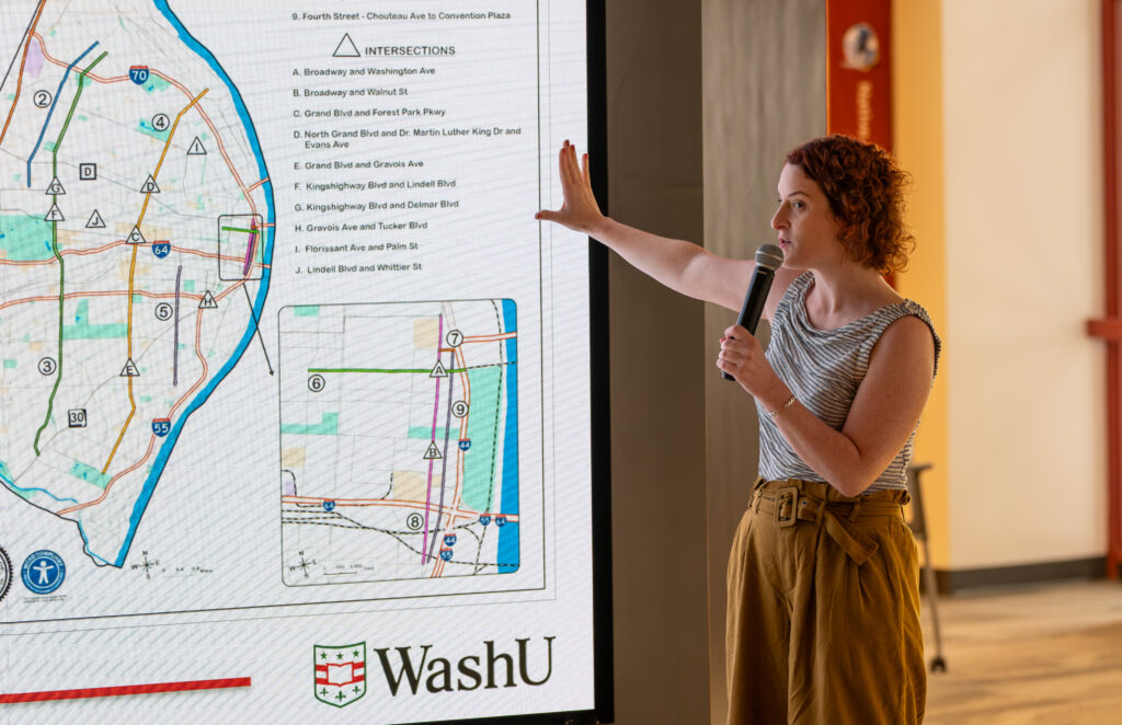
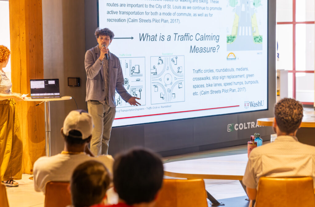
Martin and Mulligan focused on locations identified through the City’s Principal Arterial Traffic Safety Enhancements Project, a major safety initiative supported by federal American Rescue Plan Act funding.
“The city found there were nine main arterial roads and 10 intersections where there were needs for structural change and where there were high rates of crashes,” Mulligan said.
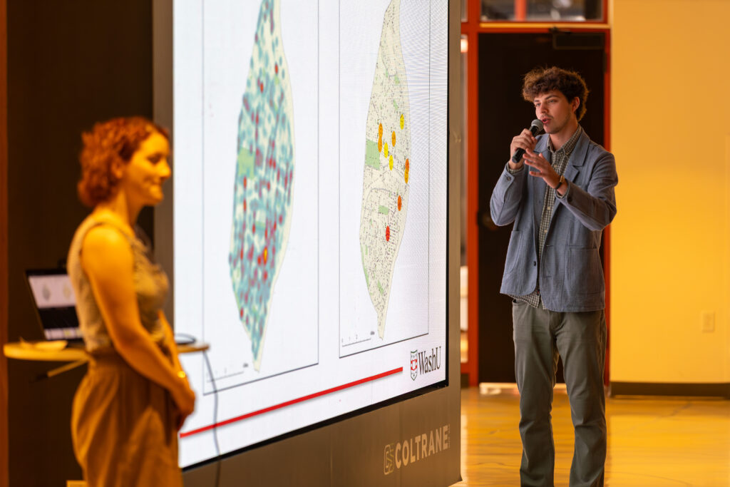
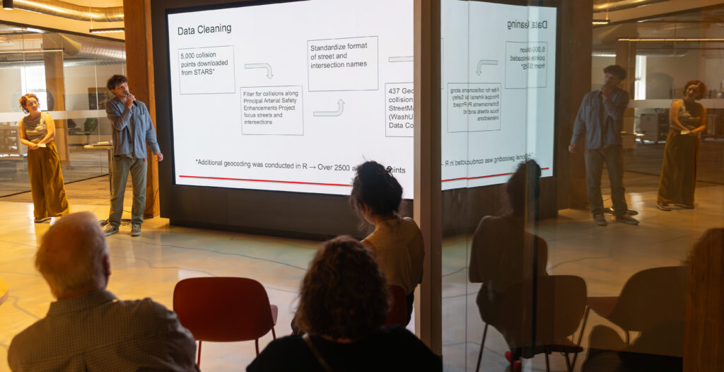
Using crash records, GIS software and publicly available infrastructure data, Martin and Mulligan mapped collision patterns and evaluated changes taking place along some of the city’s busiest corridors.
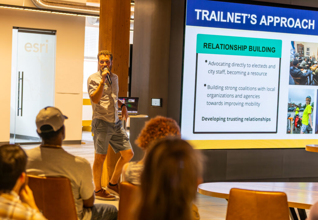
For Trailnet, understanding where crashes occur and how infrastructure improvements affect those patterns is central to its mission. The organization advocates for Complete Streets, an approach to transportation planning that seeks to make streets safer and more accessible for pedestrians, cyclists, transit riders and drivers.

Projects like Martin and Mulligan’s provide additional analysis that can help inform future planning efforts while giving students an opportunity to apply GIS skills to transportation challenges facing the region.
“I think the great thing about this partnership is that we can create something as a nonprofit and as an educational institution for people to use and build on,” said Erich Hellmer, Trailnet’s community planning manager. “You guys have created something that will be a really useful tool and something that I’m really excited about.”
Different Backgrounds, Shared Questions
Part of what made the project successful was the different experiences Martin and Mulligan brought to it.
“I was always sort of interested in spatial data and maps because I loved the New York City subway maps,” Martin said. “When the opportunity to do a transportation project came about, I was like, ‘Oh, this is perfect.’”
Mulligan’s path was different. After earning a degree in geography, she spent more than a decade working in public education and with indigenous artisans in Peru before returning to GIS.
“There’s always a component of art, but also this kind of larger component of place and kind of, I don’t know, the story behind the art,” she said.
Those varied experiences shaped how the students approached the project.
For Dorris Scott, who teaches Digital Cartography at CAPS, that process is part of the lesson.
“One of the most frequent comments I get from students about this class is, ‘Oh wow, I never really thought about our streets this way. I never really thought about our sidewalks this way,’” Scott said.
From Classroom to Community
Each fall, students in the Digital Cartography class are given broad transportation-related questions and challenged to develop their own approaches for investigating them.
For Trailnet, one of the most valuable aspects of the partnership is the fresh perspective students bring to familiar problems.
“When we work with GIS students or data science students who don’t necessarily specialize in the field of active transportation or complete streets, you get a different perspective,” said Hellmer. “It gives us an opportunity to get help from people who are really, really smart and get a different perspective.”
As a small planning team, Trailnet often uses the partnership to explore questions, datasets and mapping projects that might otherwise be difficult to pursue. The student work does not replace the organization’s planning efforts, but it frequently introduces new approaches and tools that can support them.
“It gives us a different tool that we can apply to the active ongoing planning,” Hellmer added.
While the project focused on conditions in 2025, both students see opportunities for future classes to continue building on the work.
“Our project is sort of temporally based,” Mulligan said during the presentation. “We took the 2025 year as our snapshot and then you can apply our methods to future years and then that’s where they will start getting powerful.”
As additional traffic-calming measures are installed and new data becomes available, future CAPS students may be able to use those methods to help track how St. Louis streets continue to change over time.